


It's "SNOW" Fun! Facts from the MMS Science Department
Our favorite site about Arkansas specifically is at the link below and it includes pictures:
https://www.onlyinyourstate.com/arkansas/ar-winter-storms/
Here are some other random facts to look at……..
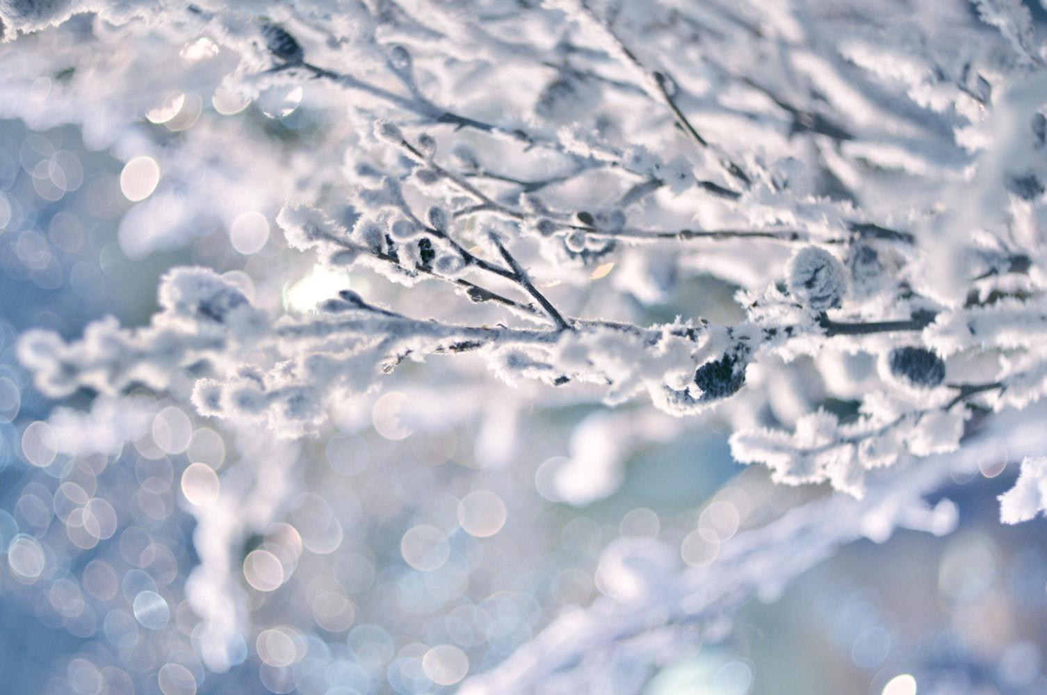
· Snow forms when water vapor in the atmosphere freezes into ice crystals.
· Snowflakes form in a variety of different shapes.
· Snow is a form of precipitation, other forms of precipitation are rain, hail and sleet.
· Light and fluffy snow is often called ‘powder’.
· Heavy snowfalls are often called ‘snowstorms’.
· Snowstorms with high winds are often called ‘blizzards’.
· Snow reflects a high level of ultraviolet radiation and can cause snow blindness (photokeratitis). Sunglasses, goggles and other eye protection help absorb the ultraviolet rays.
· A number of winter sports rely on snow, including skiing and snowboarding.
· Recreational activities such as snowball fights, tobogganing and making snowmen are also popular in the snow.
· Skis, sleds and snowmobiles are useful transport options through snow.
· Snow can lower visibility, making driving conditions dangerous.
· The highest snowfall ever recorded in a one year period was 31.1 meters (1224 inches) in Mount Rainier, Washington State, United States, between February 19, 1971 and February 18, 1972.
1. SNOWFLAKES AREN'T THE ONLY FORM OF SNOW.
Snow can also precipitate as graupel or sleet. Not to be confused with hail, graupel (or snow pellets) are opaque ice particles that form in the atmosphere as ice crystals fall through freezing cloud droplets—meaning cloud particles that are colder than the freezing point of water but remain liquid. The cloud droplets group together to form a soft, lumpy mass. Sleet, on the other hand, consists of drops of rain that freeze into small, translucent balls of ice as they fall from the sky.
2. SYRACUSE, NEW YORK TRIED TO MAKE SNOW ILLEGAL.
America’s snowiest major city has an impressive arsenal of plows, but in 1992 it tried a new trick to control white stuff. The city’s Common Council passed a decree that any more snow before Christmas Eve was illegal. As it turns out, Mother Nature is a scofflaw—it snowed just two days later.
3. IT'S A MYTH THAT NO TWO SNOWFLAKES ARE EXACTLY THE SAME.
In 1988, a scientist found two identical snow crystals. They came from a storm in Wisconsin.
4. THE LARGEST SNOWFLAKE MIGHT HAVE BEEN 15 INCHES WIDE.
According to some sources, the largest snowflakes ever observed fell during a snowstorm in January 1887 at Montana’s Fort Keogh. While witnesses said the flakes were “larger than milk pans,” these claims have not been substantiated.
5. SNOW IS TRANSLUCENT, NOT WHITE.
Snow, like the ice particles it’s made up of, is actually colorless. It’s translucent, which means that light does not pass through it easily (like it would transparent glass), but is rather reflected. It’s the light reflected off a snowflake’s faceted surface that creates its white appearance.
But why white? The reason we see objects as colors is because some wavelengths of light are absorbed while others are reflected (remember, light is a spectrum of colors). The object takes on whatever color light is reflected. For example, the sky is blue because the blue wavelengths are reflected while the other colors are absorbed. Since snow is made up of so many tiny surfaces, the light that hits it is scattered in many directions and will actually bounce around from one surface to the next as it’s reflected. This means no wavelength is absorbed or reflected with any consistency, so the white light bounces back as the color white.
6. AND, IN FACT, IT DOESN'T ALWAYS APPEAR WHITE.
Deep snow can often appear blue. This is because layers of snow can create a filter for the light, causing more red light to be absorbed than blue light. The result is that deeper snow appears blue—think about how your snowy footprints compare to the surrounding landscape.
Snow can also sometimes appear pink. Snow in high alpine areas and the coastal polar regions contains cryophilic fresh-water algae that have a red pigment that tints the surrounding snow.
7. EACH WINTER IN THE U.S., AT LEAST 1 SEPTILLION ICE CRYSTALS FALL FROM THE SKY.
That’s 1,000,000,000,000,000,000,000,000—24 zeros!
8. THE MOST SNOW TO FALL IN A 24-HOUR PERIOD IN THE UNITED STATES IS 75.8 INCHES.
In 1921, over six feet of snow fell between April 14 at 2:30 p.m. and April 15 at 2:30 p.m. in Silver Lake, Colorado.
9. COLORADO ALSO HOLDS THE RECORD FOR THE MOST SNOW TO FALL IN A SINGLE CALENDAR DAY.
On December 4, 1913, 63 inches of snow fell on Georgetown, Colorado.
10. SNOW HAS NEVER BEEN REPORTED IN KEY WEST.
The coldest temperature on record for the Florida city (reached on January 13, 1981, and January 12, 1886) is 41 degrees Fahrenheit.
11. NOT EVERY BIG SNOWSTORM IS A BLIZZARD.
In order to be classified as a blizzard, a snowstorm must meet a very specific set of qualifications. Winds must blow at least 35 miles per hour and the snowfall must reduce visibility to less than 0.25 miles for a period of at least three hours.
Other common types of snowstorms include a snow squall (an intense snowfall accompanied by strong winds that only lasts a short time) and a snowburst (a brief, intense snowfall that results in rapid accumulation of snow).
12. IGLOOS CAN BE MORE THAN 100 DEGREES WARMER INSIDE THAN OUTSIDE.
And they’re warmed entirely by body heat. Since fresh, compacted snow is approximately 90 to 95 percent trapped air (meaning it can’t move and transfer heat) it’s a great insulator. Many animals, such as bears, dig deep holes in the snow to hibernate through the winter.
13. NOVA SCOTIA HOLDS THE RECORD FOR THE MOST SNOW ANGELS EVER MADE SIMULTANEOUSLY IN MULTIPLE LOCATIONS.
In 2011, 22,022 Nova Scotia residents in 130 separate locations all plopped down in the snow to make snow angels.
14. NORTH DAKOTA HOLDS THE RECORD FOR MOST SNOW ANGELS MADE SIMULTANEOUSLY IN ONE PLACE.
Back in 2007 it was 8962 people in North Dakota who plopped down in the snow to waggle their arms and legs to make snow angels.
15. FEELING MORE DEVILISH? THE LARGEST SNOWBALL FIGHT ON RECORD TOOK PLACE IN SEATTLE.
Exactly 5834 snow fighters came together to exchange frozen barrages to create the largest snowball fight in the world on January 12, 2013.
La ciencia de la nieve - ¡Hechos curiosos!
Nuestro sitio favorito sobre Arkansas se encuentra específicamente en el siguiente enlace e incluye imágenes:
https://www.onlyinyourstate.com/arkansas/ar-winter-storms/
Aquí hay algunos otros hechos aleatorios para mirar …… ..
· La nieve se forma cuando el vapor de agua en la atmósfera se congela en cristales de hielo.
· Los copos de nieve se forman en una variedad de formas diferentes.
· La nieve es una forma de precipitación, otras formas de precipitación son la lluvia, el granizo y el aguanieve.
· La nieve ligera y esponjosa a menudo se denomina "polvo".
· Las fuertes nevadas a menudo se denominan "tormentas de nieve".
· Las tormentas de nieve con vientos fuertes a menudo se denominan "ventiscas".
· La nieve refleja un alto nivel de radiación ultravioleta y puede causar ceguera de la nieve (fotoqueratitis). Las gafas de sol, las gafas protectoras y otras protecciones para los ojos ayudan a absorber los rayos ultravioleta.
· Varios deportes de invierno dependen de la nieve, incluido el esquí y el snowboard.
· Las actividades recreativas como las peleas de bolas de nieve, el trineo y la fabricación de muñecos de nieve también son populares en la nieve.
· Los esquís, trineos y motos de nieve son opciones útiles de transporte a través de la nieve.
· La nieve puede reducir la visibilidad y hacer que las condiciones de conducción sean peligrosas.
· La nevada más alta jamás registrada en un período de un año fue de 31,1 metros (1224 pulgadas) en Mount Rainier, estado de Washington, Estados Unidos, entre el 19 de febrero de 1971 y el 18 de febrero de 1972.
1. LOS COPOS DE NIEVE NO SON LA ÚNICA FORMA DE NIEVE.
La nieve también puede precipitarse en forma de aguanieve o aguanieve. No confundir con granizo, graupel (o gránulos de nieve) son partículas de hielo opacas que se forman en la atmósfera cuando los cristales de hielo caen a través de gotas de nubes heladas, es decir, partículas de nubes que son más frías que el punto de congelación del agua pero permanecen líquidas. Las gotas de la nube se agrupan para formar una masa suave y grumosa. El aguanieve, por otro lado, consiste en gotas de lluvia que se congelan en pequeñas bolas de hielo translúcidas a medida que caen del cielo.
2. SYRACUSE, NUEVA YORK INTENTÓ HACER ILEGAL A LA NIEVE.
La ciudad principal más nevada de Estados Unidos tiene un impresionante arsenal de arados, pero en 1992 intentó un nuevo truco para controlar la materia blanca. El Consejo Común de la ciudad aprobó un decreto por el que cualquier nevada antes de la Nochebuena era ilegal. Resulta que la madre naturaleza es una burlona: nevó solo dos días después.
3. ES UN MITO QUE NO HAY DOS COPOS DE NIEVE EXACTAMENTE IGUALES.
En 1988, un científico encontró dos cristales de nieve idénticos. Vienen de una tormenta en Wisconsin.
4. EL COPO DE NIEVE MÁS GRANDE PODRÍA HABER MIDO 15 PULGADAS DE ANCHO.
Según algunas fuentes, los copos de nieve más grandes jamás observados cayeron durante una tormenta de nieve en enero de 1887 en Fort Keogh de Montana. Si bien los testigos dijeron que los copos eran "más grandes que los recipientes de leche", estas afirmaciones no se han comprobado.
5. LA NIEVE ES TRANSLÚCIDA, NO BLANCA.
La nieve, al igual que las partículas de hielo que la componen, en realidad es incolora. Es translúcido, lo que significa que la luz no lo atraviesa fácilmente (como lo haría con un vidrio transparente), sino que se refleja. Es la luz reflejada en la superficie facetada de un copo de nieve lo que crea su apariencia blanca.
¿Pero por qué blanco? La razón por la que vemos los objetos como colores es porque algunas longitudes de onda de luz se absorben mientras que otras se reflejan (recuerde, la luz es un espectro de colores). El objeto adquiere cualquier color de luz que se refleje. Por ejemplo, el cielo es azul porque las longitudes de onda azules se reflejan mientras que los otros colores se absorben. Dado que la nieve está formada por tantas superficies diminutas, la luz que la golpea se dispersa en muchas direcciones y, de hecho, rebota de una superficie a otra a medida que se refleja. Esto significa que ninguna longitud de onda se absorbe o refleja con consistencia, por lo que la luz blanca rebota como el color blanco.
6. Y, DE HECHO, NO SIEMPRE APARECE BLANCO.
La nieve profunda a menudo puede parecer azul. Esto se debe a que las capas de nieve pueden crear un filtro para la luz, lo que hace que se absorba más luz roja que azul. El resultado es que la nieve más profunda parece azul; piense en cómo se comparan sus huellas nevadas con el paisaje circundante.
La nieve a veces también puede parecer rosada. La nieve en las áreas alpinas altas y las regiones polares costeras contiene algas criófilas de agua dulce que tienen un pigmento rojo que tiñe la nieve circundante.
7. CADA INVIERNO EN EE. UU., AL MENOS 1 SEPTILLION CRISTALES DE HIELO CAEN DEL CIELO.
Eso es 1,000,000,000,000,000,000,000,000: ¡24 ceros!
8. LA MAYOR NIEVE QUE CAE EN UN PERIODO DE 24 HORAS EN LOS ESTADOS UNIDOS ES 75.8 PULGADAS.
En 1921, cayeron más de seis pies de nieve entre el 14 de abril a las 2:30 p.m. y el 15 de abril a las 2:30 p.m. en Silver Lake, Colorado.
9. COLORADO TAMBIÉN TIENE EL RÉCORD DE LA MAYOR NIEVE QUE CAE EN UN ÚNICO DÍA CALENDARIO.
El 4 de diciembre de 1913, cayeron 63 pulgadas de nieve en Georgetown, Colorado.
10. NUNCA SE HA REPORTADO NIEVE EN KEY WEST.
La temperatura más fría registrada para la ciudad de Florida (alcanzada el 13 de enero de 1981 y el 12 de enero de 1886) es de 41 grados Fahrenheit.
11. NO TODAS LAS GRANDES TORMENTAS DE NIEVE SON UN BLIZZARD.
Para ser clasificada como ventisca, una tormenta de nieve debe cumplir un conjunto de requisitos muy específicos. Los vientos deben soplar al menos a 35 millas por hora y las nevadas deben reducir v a menos de 0.25 millas por un período de al menos tres horas.
Otros tipos comunes de tormentas de nieve incluyen una ráfaga de nieve (una nevada intensa acompañada de fuertes vientos que solo duran poco tiempo) y una ráfaga de nieve (una nevada breve e intensa que resulta en una rápida acumulación de nieve).
12. LOS IGLOOS PUEDEN SER MÁS DE 100 GRADOS MÁS CALIENTES EN EL INTERIOR QUE EN EL EXTERIOR.
Y se calientan completamente con el calor corporal. Dado que la nieve fresca compactada contiene aproximadamente entre un 90 y un 95 por ciento de aire atrapado (lo que significa que no puede moverse ni transferir calor), es un gran aislante. Muchos animales, como los osos, cavan agujeros profundos en la nieve para hibernar durante el invierno.
13. NOVA SCOTIA LLEVA EL RÉCORD DE LA MAYORÍA DE ÁNGELES DE NIEVE JAMÁS HECHOS SIMULTÁNEAMENTE EN MÚLTIPLES LUGARES.
En 2011, 22,022 residentes de Nueva Escocia en 130 lugares separados se dejaron caer en la nieve para hacer ángeles de nieve.
14. EL NORTE DE DAKOTA TIENE EL RÉCORD DE LA MAYORÍA DE LOS ÁNGELES DE LA NIEVE REALIZADOS SIMULTÁNEAMENTE EN UN LUGAR.
En 2007, 8962 personas en Dakota del Norte se dejaron caer en la nieve para mover los brazos y las piernas para hacer ángeles de nieve.
15. ¿SE SIENTE MÁS DIABLO? LA LUCHA DE BOLAS DE NIEVE MÁS GRANDE QUE SE HAYA HISTORIAL SE LLEVÓ A CABO EN SEATTLE.
Exactamente 5834 luchadores de nieve se reunieron para intercambiar bombardeos congelados para crear la pelea de bolas de nieve más grande del mundo el 12 de enero de 2013.


