It's China
All You Need to Know About China
People's Republic of China
Geography
China is found in Eastern Asia, bordering the East China Sea, Korea Bay, Yellow Sea, and South China Sea, between North Korea and Vietnam.
Melting snow from the mountains in the west create the headwaters for two of China's rivers, the Yellow River and the Yangzi River.
The massive land of China include plateaus, plains, basins, foothills, & mountains. Defining rugged plateaus, foothills & mountains, they occupy nearly two-thirds of the land, higher in the West and lower in the East.
China is found in Eastern Asia, bordering the East China Sea, Korea Bay, Yellow Sea, and South China Sea, between North Korea and Vietnam & China is bordered by 14 other countries
China has over 1,500 large rivers and 370 large lakes
Over 5,000 little to big islands are scattered in China's territorial waters
China is:
33% Mountains
26% plateaus
10% hills
12% lowlands
19% basins
*In the south it is wet and tropical, with some rainforest coverage.
*In North-west China, it is covered in almost all desert.
*In the very far north-east, close to Russia, the temperature can drop to -50ºC in the winter.
Geographic Regions
Some Examples of Some of The 5 Geographic Regions
Tibetan-Highlands
Xinjiang-Mongolia
Northeastern Plain
Tibetan-Highlands
Some of the worlds largest Mountains like the Himalayas, Karakorum, Tian Shan, & the Parmirs divide North China from South China. Eleven of the seventeen tallest Mountain Peeks are on China's western border and that includes the worlds tallest, Mt. Everest in the Himalayan Mountains standing tall at 8,848 meters. Which also borders K2 the second tallest Mountain peek.
North of Himalayas and east of Karakorum lies the "Roof of the World", the Tibet Plateau. It covers at least 1/5 of China's landmass( so about 2.5 million square kilometers) and stands exceeding 4,500 meters . It stretches 1,500 kilometers north to south and 2,500 kilometers east to west. In the North it is closed in by the Kunlun Mountains, which shoots off eastward. It is known at the "Third Pole" and/or " Water Tower of Asia" because of the mountain tops and slopes along with glaciers and rivers that hold water the flow to all of Asia. It is also "crisscrossed" by 14 amazing mountain ranges. It also holds a lot of valuable untouched natural resources
Eastern Asia
Northeast Plain
Too Northeast of Shanhaiguan, a slender sliver of flat costal land opens up into the massive Manchurian Plain. The Manchurian Plain lies in between the Greater and Lesser Khingan and the Changbai mountains. It is China's largest plain at an elevation of lower 200 m and it covers 350,000 kilometers squared. The Ren River, Liaohe River, & the Songhai River runs throughout its massive and fertile land. The plain has the Songnan Plain in the North, Liaohe Plain in the South, & the Shangjiang Plain in the Northeast.
It is great for farming in most part, but it has a high chance, & is known for flooding. It has wetlands & massive marshes.
North Plain
There are 3 sides to the triangular North China Plain.
The Taihang mountains is a mountain range that makes up the western side of the triangle. It goes down the eastern edge of the, Loess Plateau in Shanxi, Henan, & Hebei provinces. The mountain range has an average elevation of 1,500 to 2,000 meters/4,900 to 6,600 feet, & expands over 400 kilometers North to South. The Red Flag Canal can be found on the edge of the Taihang Mountains. The Shitai Passenger Railway goes under it via the Taihang Tunnel that is almost 17 miles/ 28 kilometers, creating the longest railroad in China.
The other sides of the triangle are the Yangtze river to the Southwest & the Pacific coast to the East.
This Plain is fed with the Yangtze & Yellow River making it one of the heavily most popular places in China to live. It has the Taishan in Shandong & Dabie Mountains of Anhui.
The Great wall of China spreads across the mountains that mark the edge of the Inner Mongolian Plateau.
The three points of the triangle are Beijing to the North, Shanghai to the southeast, & Yichang to the southwest.
South (Hills)
Southeast of the Tibetan Plateau and south of the Sichuan Basin is the Yunnan-Guixhou Plateau, which occupies most of southwest China. The Yunnan-Guixhou plateau has an average elevation of 2,000 meters & is known for its limestone karst landscape.
Area South of the Yangtze, has landscape which is more rugged. For example, the Shanxi Province to the north, each of Hunan & Jiangxi have a core in a river basin that is surrounded by mountains. Then the Wuling range separates the Guizhou from Hunan. Not to mention the Luoxiao and Jinggang divide the Hunan from Jiangxi, which is divided from Fujian by the Wuji Mountains. Southeast coastal provinces, Zhejiang, Fujian and Guangdong, have coasts that are rugged. The Nanling Mountain Range goes east to west & goes across northern Guangdong, to seal off Hunan and Jiangxi from Guangdong.
Xinnjiang-Mongolia
Northwest of the Tibetan Plateau, in between the northern slope of Kunlun and southern slope of Tian Shan, is the massive Tarim Basin of Xinjiang. The Tarim Basin is in Northwest China in the Xinjiang Region. It measures 1,500 km from east to west and 600 km from north to south at its widest parts and its average elevation is 1,000 meters, so it occupies about 906,500 km2 (350,000 sq miles). It is bordered by the Tian Shan mountain range in the North & its southern birder is the Kunlun mountains. The basin is mostly taken up by Taklamakan Desert.
The Taklamakan Desert has an area of 337,000 km2 (130,116 sq. mi.). The Taklamakan Desert is the world's second largest shifting sand desert with about 85% made up of shifting sand dunes. Making it rank 18th in size in a ranking of the world's largest non-polar desert.
To the East it travels into the Hami-Turpan Depression of eastern Xinjiang, where a dry lake bed called, Lake Ayding is at -154 meters below sea level. It is the lowest surface in China and 3rd in the world. The lake bed is one of the hottest places at china reaching at 49.6 C.
North of Tian is Xnjiang's second great basin called the Junggar. The Junggar contains the Gurbantunggut Desert. The Junggar covers approximately 777,000 km2 (300,000 sq miles), extending into eastern Kazakhstan & western Mongolia.
The Junggar Basin is enclosed to the north by the Altay Mountains which is a divider for Xinjiang from Russia & Mongolia
Northeast of the Tibetan Plateau, a mountain range called the Altun Shan and the Qilian, branches off the Kunlun and makes a parallel mountain range running east to west.
In the middle in northern Qinghai is the Qaidam Basin, with which has an elevation of 2,600-3,000m not to mention multiple brackish and salt lakes.
North of the Qilian is the Hexi Corridor of Gansu, a natural passage between Xinjiang and China Proper & rail lines which lead to Xinjiang.
Than further North is the Inner Mongolia Plateau (between 900-1,500m in elevation) which than if you go even further North of the plateau you get the Greater Hinggan Range of Northeast China.
The Loess Plateau is in between Qinling & the Inner Mongolian Plateau. The Loess Plateau, is the largest of its kind in the world. It covers 650,000 km² in Shaanxi, parts of Gansu & Shanxi provinces. Not to mention some of Ningxia-Hui Autonomous Region. The Loess plateau is 1,000-1,500 meters in elevation. The Loess Plateau is attached to the east by the Luliang Mountain of Shanxi, which contains a slender basin running north to south along the Fen River. Further east is the Taihang Mountains of Hebei.
Seasons
Spring
May is a transition month in China; a bridge from winter to summer. The Siberian High is beginning to recede & becoming warmer in the growing sunshine of Siberia's northern latitudes. As this system pulls north, northern China sees its first warmth from the bitter cold of winter since September or October. The primary storm track is still in Siberia although the cold fronts it drags behind begin to extend further and further south. The
Pacific High is growing & the Indonesian Low is developing over the getting warmer waters of the western Pacific.
With the approach of Spring, moisture lade southwesterly winds begin going northward into China pushing in the monsoon season. As spring comes northward across China, it has daytime temperatures that go between 20 and 30C & there is less rain on the Manchurian Plain and some plateaus. Daytime temperatures range from 20 to 30 C . Although it can become quite hot during the day, nights can get bitterly cold and bring frost.
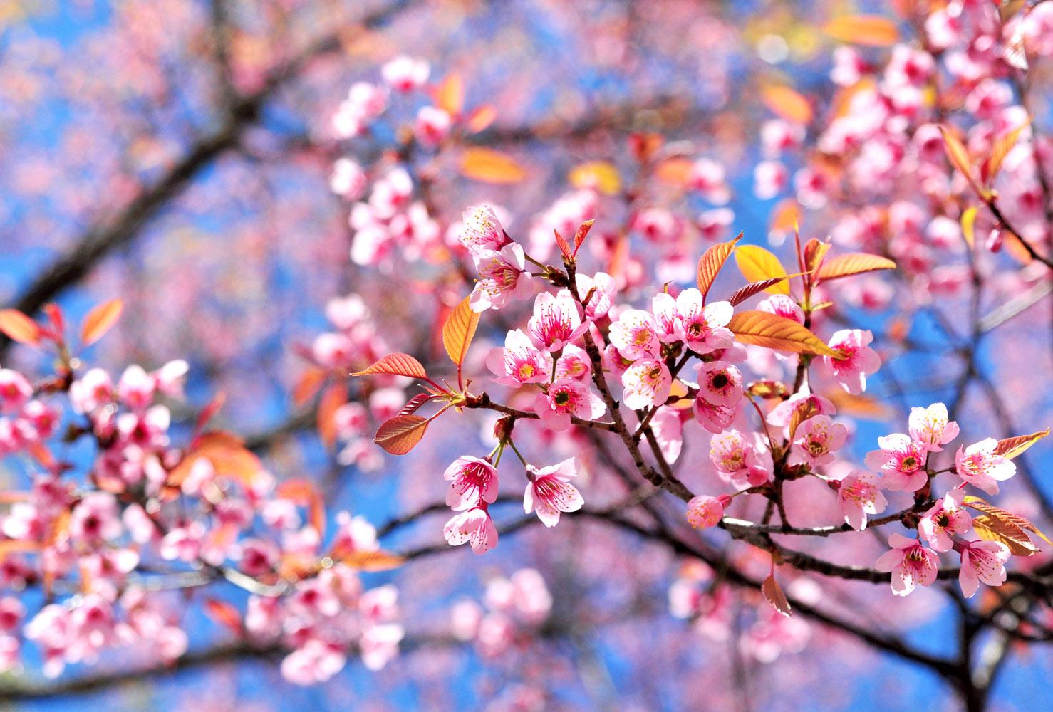
Springtime on the North China Plain is a time when the entire landscape seems to be in multiple shades of green. Clear sky can be expected. It is temperate and cool. Temperatures begin to get warmer in this region during May. The month still can expect time of cool, dry weather and frequent strong winds that blow dust across the plain, but warmer & humid winds come from the south to warm it up. There is no real dividing line between winter and spring in Beijing & it doesn't last long.
In southern and southeastern China, day temperatures ranging between 20 & 25 C, but it can get miserably wet and cold, with rain &/or drizzle.
Moonson
Summer
The Manchurian Plain in northeast China experiences hot and dry summer. Across northern and central China, summertime can be quite hot with almost continual rainfall. The desert regions of China's northwest and western interior get hot in summer& dry. Average high temperatures vary from 68 F & 91 F in July. The Turpan Depression in northwest China, is one of the hottest place in China with maximums of around 117 F. Summertime in Eastern China has not only heat, but humidity. In the North and South most of the rain falls during summer and plenty of rain can be expected in July and August. The combination of high temperatures and high humidity make for an oppressive climate. In the Yangtze River valley area, along with Shanghai, summers are long, hot and humid. The Chinese have dubbed the cities of Wuhan, Chongquing, and Nanjing "the three furnaces." Beijing has a short summer but it is still hot. Summers in Tibet & Qinghai Province are comfortable, with valley temperatures around 75 F in July. The snow line in the north and east climbs to between 5000 meters & 6000 meters, & in the south it's even higher. However temperatures can go down dramatically in the shade and at night.
The semi-tropical summer climate of southern and southeastern China brings a substantial amount of rainfall during Summer. In the far south, around Guangzhou, the heat and humidity have their greatest impact from around April through September. On Taiwan, summer average temperatures rarely surpass 89.6 F. August is the hottest month among China's South China Sea Islands. In southern China there is the potential for typhoons between July and September.
Fall
The month of September is a transition month in China, a bridge from summer to fall.
Cold fronts begin to extend further south. Temperatures above 29°C are still possible across northern China, but by the end of the month frosts & freezes are common on the Manchurian Plain and across the northern plateaus. Daytime temperatures range from 20 to 30°C and there is less rain. Although it can be quite warm during the day, nights can be bitterly cold and bring frost.
China's northern interior is the first to feel the change of seasons. The Siberian High grows increasingly cold as sunshine dwindles quickly above the Arctic Circle. It brings significant drops in temperature, gusty winds, & frosts &freezes at night. Average temperatures, though still blistering hot, drop an average 5 to 6°C lower than in August. The descending cold fronts displace warm, moist tropical air, causing heavy thunderstorms, even some severe weather across central and eastern China. Towards the end of the month you will be able to see the leaves turning color.
September is also the peak of the typhoon season. The tropical disputes that form over the western Pacific, the Philippine Sea, & the South China Sea are at their peak usually in September. Many of these developing weather systems become tropical storms or typhoons and recurve north over the Philippine Sea to stop over the cool waters of the Sea of Japan or become absorbed in extratropical storm systems
As temperatures begin to accelerate downwards over the North China Plain during September, Beijing enjoys clear skies and cool temperatures in its first real break from the heat and humidity since June. Bouts of warm and humid weather are still possible, but frontal systems increasingly bring warm, drier Siberian air into northern China. Cold fronts bring showers and heavy thunderstorms across the plain. The cause for most concern is the tropical storms &/or typhoons that threaten the region with flooding rains, especially when the moist winds are forced upward over the coastal hills.
Rainfall diminishes everywhere but southernmost China. As autumn brings mild days and the first hints of cooler air at night. Along the South China Sea, the daily sea breeze circulation gets weak and diminishes the daily thunderstorm activity that develops in the summer. Even though daytime high temperatures range from 20 to 25°C, tropical moisture is usually still in control &/or easily within reach to make the days miserably wet and cold, with rain or drizzle.
Southern and southeastern China are the first to feel the heat of summer and the last to see it go. Average temperatures begin to drop off but it is still very warm. This region is increasingly vulnerable to tropical disputes, storms, & typhoons threaten heavy flooding rains, damaging winds, and tides. The first polar fronts to reach southern China tend to be weak, bringing almost nothing but little drier air.
Tibet and Qinghai Province can change insanely fast. Heat from summer can be felt one day and a strong cold winds can bring mountain snows the next.
Winter
Incredibly cold, winters in northeastern and northern China fall in between December and March. Average daily temperatures in Shenyang, Manchuria, are between -18 and -6 C in January. On the north central Manchurian Plain, January brings average daily high temperatures of just -13 C and low temperatures that hover around -23 C. Manchuria's rivers stay frozen for a average of five months each year.
Over the North China Plain, winter is relatively long and with often north winds bringing dry arctic air out of Mongolia. While Beijing's January average high is just 1°C, it is usually dry and sunny. Nighttime temperatures can drop to below -8°C.
North of the Great Wall in Inner Mongolia, it's much colder with temperatures dropping down to -40°C. Winters in the Yangtze River valley are short and cold, with temperatures dipping well below freezing. It can also be wet and miserable at anytime apart from summer.
Across northwest China, Winter is cold like the rest of northern China, but a lot drier.
January temperatures in the desert regions of China's northwest and western interior range from -11 to 1°C. In Urumqi, in central Sinkiang Province, the average high temperature in January is -8°C, with minimums down to almost -30°C . Temperatures in the Turfan Depression are only slightly more favorable to human existence.
China's southeastern region has cool winters with substantial rainfall. The far south, around Guangzhou has a short winter from January to March that is definitely not as cold as in the north. Guangzhou's average high temperature in January is a pleasant 17°C , with overnight lows drooping to around 10°C. Temperatures have dropped to 1°C in December and January. February is the coldest month among the South China Sea Islands.
Winter brings an intense cold and fierce winds to Tibet and Qinghai Province. Winters here are particularly harsh, with valley temperatures hovering around -10 C in January.
Elements of Culture
In such diffused changes of culture two factors are necessary: contact and understanding.
-Hu Shih
There is 7 Elements of Culture:
* Language
* Religion
* Economics
* Government
* Social Organization
* Arts and Literature
* Customs and Traditions
Language
China has 292 living languages & 1 extinct language(jurchen) according to Ethnologue.
Mandarin is the most spoken in china by possibly more people than any other language with over 1.3 billion. It is the main language of government, the media and education in China and Taiwan, and one of the four official languages in Singapore.
Chinese is a family of closely-related but mutually unintelligible languages. Those languages are known as fāngyán (regional languages), dialects of Chinese or varieties of Chinese.
Over 1.2 billion people speak one or more varieties of Chinese.
All varieties of Chinese belong to the Sino-Tibetan family of languages and each one has its own dialects and sub-dialects, which are more or less mutually intelligible.
Standard Chinese or Mandarin (official; Putonghua, based on the Beijing dialect), Yue (Cantonese), Wu (Shanghainese), Minbei (Fuzhou), Minnan (Hokkien-Taiwanese), Xiang, Gan, Hakka dialects, minority languages (see Ethnic groups entry)
note: Zhuang is official in Guangxi Zhuang, Yue is official in Guangdong, Mongolian is official in Nei Mongol, Uighur is official in Xinjiang Uygur, Kyrgyz is official in Xinjiang Uyghur, and Tibetan is official in Xizang (Tibet).
I Got the Languages from the world factbook.( https://www.cia.gov/library/publications/the-world-factbook/geos/ch.html)
Religion
Religion
Religion
Religion
China has been a multi-religion country since the ancient times. With there being not one main religion but many little ones.
Over 100 million followers of the various faiths. The main religions are Buddhism, Islam, Christianity, Taoism along with Shamanism, Eastern Orthodox Christianity and the Naxi people's Dongba religion
Confucianism and Taoism, plus Buddhism, constitute the "Three Teachings".
The Chinese go and pray at temples and at home, it really depends on your religion.
In 2010 the percentages for religion where with:
Buddhist 18.2%
Christian 5.1%
Muslim 1.8%,
folk religion < .1%
Hindu < .1%,
Jewish < .1%
other 0.7% (includes Daoist (Taoist)), unaffiliated 52.2%
(Got numbers/percentages from world factbook)
Economics
Economics
Economics
Economics
China is a member of the WTO & is the world's largest trading power, with a total international trade value of US$3.87 trillion in 2012.
$9,800 is the 2013 estimate of China's GDP.
China exported an estimated $2.21 trillion & Imported an estimated $1.772 trillion in 2013.
GDP- Composition, by sector of origin:
agriculture: 9.7%
industry: 45.3%
services: 45%
The USA trades a lot with China that most of the things you buy are from China and they are saving the US money we pay to buy things from us (company/businesses).
China is still developing & evolving today.
It is one of the best in the world.
Government
China's original name is the People's Republic of China.
Independence Day is October 1
Capital City: Beijing
It has 23 provinces & 5 autonomous regions
It's a communist state.
Local People's Congresses are directly elected, and all higher levels of People's Congresses up to the National People's Congress, the national legislature, are indirectly elected by the People's Congress of the level immediately below.
The ruler of China is President Hu Jintao. He occupies the highest state office in the People Republic of China & exercises the functions & powers of head of state. Jintao promulgates laws, appoints and removes members of the State Council, issues orders, receives foreign diplomatic representatives on behalf of the China.
Japan has an advanced military, with 2.3 million active troops, the People's Liberation Army (PLA) is the largest standing military force in the world, & is recognized as a major regional military power and a potential military superpower.
The renminbi is the official currency of the People's Republic of China. The Yuan is the basic unit of renminbi.
Social Organization
In China life revolves around the family.
It is important to always respect your Elders.
Boys were preferred instead of girls because the boys will take care of the Parents when they get older.
Arts and Literature
Chinese art is greatly influenced by china's spiritual history, many sculpture, painting, & drawings are spiritual figures from Buddhism and other gods.
There is many sports played in China. Here are just a few of them:
* Basketball
* Volleyball
* Chinese Football (Soccer)
* Ping Pong
* Badminton
* Weiqi
**Martial Arts
* Boxing
Literature played a big part in China's history, extending thousands of years, from the earliest recorded dynastic court archives.
Chinese take pride in their paintings, poetry, pottery, paper cutting, jade cutting, & shadow puppetry.
Customs & Traditions
Chinese writing dates back over 3,000 years, characters were originally pictures representing their meaning and have evolved into the language used today. Calligraphy.
Beijing Opera is a uniquely Chinese form of theatre that relates stories of romance, legend and battles. There used to be troupes that travelled China to put on the shows.
Chinese Shadow Puppetry which was popular during the Song Dynasty during the holiday season. The stories of the shadow puppets told of events that had happened elsewhere in the country and stories with a Buddhist like background.
The Chopsticks are a tradition that developed over the years in the past and are considered extensions of the fingers that can take heat or cold.
Festivals are considered traditions like the Chinese New Year and Year of the Dragon etc...
Traditional Chinese weddings
5 Climate Zones
Cold-Temperate Zone: north part of Heilongjiang Province and Inner Mongolia.
Mid-Temperate Zone: Jilin, northern Xinjiang, and most of Heilongjiang, Liaoning, and Inner Mongolia.
Warm-Temperate Zone: area of the middle and lower reaches of the Yellow River, Shandong, Shanxi, Shaanxi, and Hebei Province.
Subtropical Zone: South of isotherm of Qinling Mountain-Huaihe River, east of Qinghai-Tibet Plateau.
Tropical Zone: Hainan province, southern Taiwan, Guangdong, and Yunnan Province
Plateau Climate Zone : Qinghai-Tibet Plateau
Ethnic group
The government officially recognizes 56 ethnic group.
Han Chinese 91.6%,
Zhuang 1.3%,
other (includes Hui, Manchu, Uighur, Miao, Yi, Tujia, Tibetan, Mongol, Dong, Buyei, Yao, Bai, Korean, Hani, Li, Kazakh, Dai and other nationalities) 7.1%
The first writing was pictographs which than help create the Chinese symbols.
There is over 50,000 pictographs known
Chinese Legends
A Legend about how Nu Gua created human beings
Nu Gua was sitting by the banks of the Yellow River one day. She admired the beauty of the river and the land but felt sad that it was such a lonely and quiet place. She started to make little models of the gods out of the yellow clay that lay on the banks of the Yellow River.
When she had finished making each model it magically came to life. These were the first people on earth.
It was taking Nu Gua a very long time to model each person. So, she started to use a cane from the river to flick droplets of the yellow clay. Each droplet transformed into a human being.
It is said that the people who were modeled by Nu Gua's hand became the rich, powerful and fortunate people. The people formed by the cane became the poor and unlucky people on earth.
Another story about Nu Gua tells how she saved the world from a great flood.
One day a great hole opened in the sky. Water came pouring out of it. Thousands of people were swept away as the rivers burst their banks and the waters rose to great heights. Other people survived only by climbing to the tops of the highest mountains.
Nu Gua looked down on what was happening, and was horrified to see the people suffering so much. She took a magical five-colored stone and melted it down until it was a hot lava. She used this to fix the hole in the sky.
She then sacrificed the heavenly tortoise and used its legs to hold up the four corners of the sky. She stopped the floods by using soil to create huge dams and lakes.
Huang Di, the Yellow Emperor, was pleased that Nu Gua had saved the people on Earth. Nu Gua however did not want a reward or any shrines to be erected in her honour. She instead asked for Huang Di to look after the people on earth better from then on. She then disappeared.
The people were so grateful that they made many temples and statues in honour of Nu Gua in spite of her wishes. However, after the day she spoke to Huang Di, Nu Gua was never seen on Earth again.
A little fun fact connecting to the legend of when Nu Gua saved the world from a great flood.
Flooding was a constant worry for the people who lived around the Yellow River. It is often called China's Sorrow as it is prone to devastating flash floods.
DBQ's
1. Using the picture above, What do you believe the artist is trying to tell you?
a. The US is getting bullied by China
b. China has tried and is trying to take over the United State's oil and is catching up to the US on economics and money
c. The US shrunk and China Grew
d. The Chinese don't have any oil so they bully other countries for it.
2. Using the picture above, what do you believe the artist is trying to tell you?
a. China spends more on imports than exports
b. China is constantly growing
c. China is developing fast
d. China exports a lot and has things sold all over the world
e. China is one of the leading exports for the market in the world and they do more exports than imports
Using the graph provided, answer the Questions.
1. what place in ranking 1 being the most to 4 being the least is Industrial?
a. first
b. second
c. third
d. fourth
e. fifth
2. What place is transportation when 1 is the least and 4 is the most?
a. fourth
b. second
c. third
d. first
e. fifth