


What is Uluru
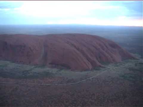
In modern scientific terms, Ayers Rock is a large sandstone rock formation in the Northern territory of central Australia (NT). The Uluru is just the outward protrusion of a larger underground structure. This unusual visible section is some 350 metres high and 8 km around, a truly impressive natural wonder.
There is almost no vegetation on the rock which is covered with rain grooves along its sides as well as caves, pools, etc.

Uluru Map
Uluru lies west of the Simpson Desert, not far from the center of Australia, about 335kms southwest of Alice Springs and 463kms by road. Uluru is located in the southwestern corner of Australia’s Northern Territory. The closes town to Uluru is Yulara. Yulara is 20kms from Uluru.
Website: https://maps.google.com.au/maps?hl=en&tab=wl&authuser=0
Location: Uluru, Northern Territory, Australia
Phone: )
